Lethan’s Extension – Proposed site plan
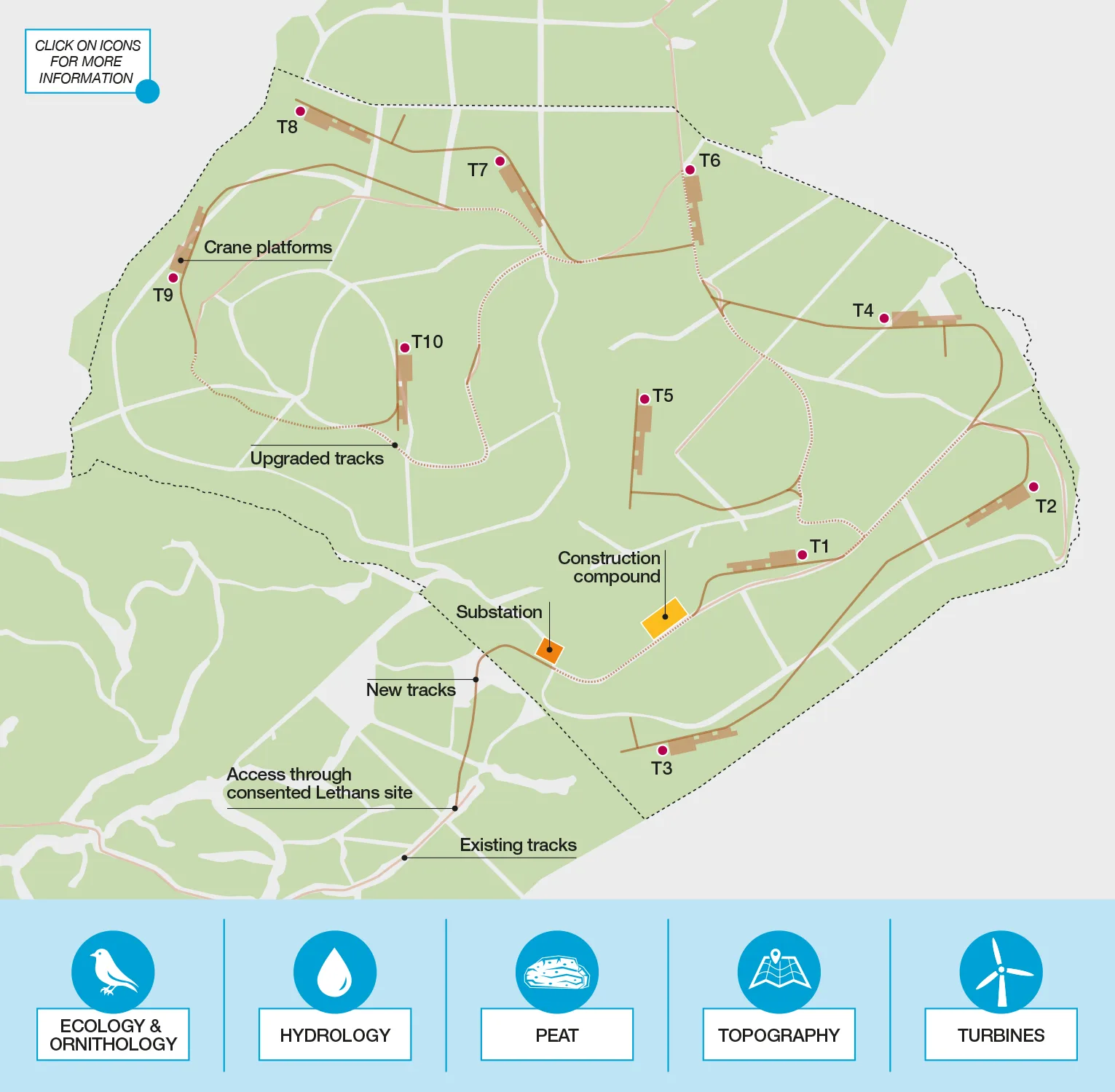
Hydrology
The Lethans Extension site features a number of watercourses. The turbines, access tracks and supporting infrastructure have been carefully position to stand off the watercourses with an appropriate buffer. Watercourse crossings have been located sensitively to minimise disturbance to habitats.
Ecology & Ornithology
Surveys have been carried out over a number of years for both the original Lethans site and Extension. Detailed assessment work will support the planning application including modelling of potential collision risk to birds. The site design and construction methods will seek to minimise ecological impacts as much as possible.
Peat
This area of Scotland has some areas of deep peat. Peat is a valuable carbon store, helping to keep carbon out of the atmosphere which is important for climate change. We have carried out surveys to understand the extent and depth of peat across the site, and this information has informed the site design to minimise peat disturbance as much as possible.
Topography and Landscape
The Lethans Extension site is located in an undulating, upland landscape which does not fall within any nationally or locally designated landscape areas. The landscape is considered suitable to accommodate wind farms, and the turbines have been carefully position with consideration for views from important receptors and interaction with the consented Lethans Wind Farm.
Turbines
Turbine technology and efficiency is advancing rapidly and we expect each turbine installed at Lethans Extension to be able to generate up to 6MW. This is enough to power thousands of homes.